


Cactus 17 Voting District, Graham County, Arizona
About
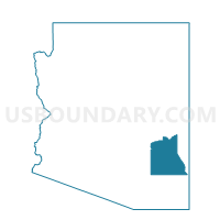
Outline

Summary
| Unique Area Identifier | 523832 |
| Name | Cactus 17 Voting District |
| County | Graham County |
| State | Arizona |
| Area (square miles) | 128.25 |
| Land Area (square miles) | 128.18 |
| Water Area (square miles) | 0.07 |
| % of Land Area | 99.95 |
| % of Water Area | 0.05 |
| Latitude of the Internal Point | 32.68710940 |
| Longtitude of the Internal Point | -109.78612430 |
Maps


Graphs
Select a template below for downloading or customizing gragh for Cactus 17 Voting District, Graham County, Arizona


Neighbors
Neighoring Voting District (by Name) Neighboring Voting District on the Map
- Bonita 13 Voting District, Graham County, AZ
- Central 8 Voting District, Graham County, AZ
- Jackson 18 Voting District, Graham County, AZ
- Layton 4 Voting District, Graham County, AZ
- Pima 9 Voting District, Graham County, AZ
- Safford 15a Voting District, Graham County, AZ
- Safford 15b Voting District, Graham County, AZ
- Thatcher 7 Voting District, Graham County, AZ
Top 10 Neighboring County Subdivision (by Population) Neighboring County Subdivision on the Map
- Safford CCD, Graham County, AZ (24,993)
- Pima CCD, Graham County, AZ (4,294)
- Bonita-Klondyke CCD, Graham County, AZ (3,153)
Top 10 Neighboring Place (by Population) Neighboring Place on the Map
- Safford city, AZ (9,566)
- Thatcher town, AZ (4,865)
- Swift Trail Junction CDP, AZ (2,935)
- Cactus Flats CDP, AZ (1,518)
Top 10 Neighboring Elementary School District (by Population) Neighboring Elementary School District on the Map
Top 10 Neighboring Unified School District (by Population) Neighboring Unified School District on the Map
- Safford Unified District, AZ (16,677)
- Thatcher Unified District, AZ (7,416)
- Pima Unified District, AZ (3,747)
Top 10 Neighboring State Legislative District Lower Chamber (by Population) Neighboring State Legislative District Lower Chamber on the Map
Top 10 Neighboring State Legislative District Upper Chamber (by Population) Neighboring State Legislative District Upper Chamber on the Map
Top 10 Neighboring 111th Congressional District (by Population) Neighboring 111th Congressional District on the Map
Top 10 Neighboring Census Tract (by Population) Neighboring Census Tract on the Map
- Census Tract 9614, Graham County, AZ (4,947)
- Census Tract 9615, Graham County, AZ (4,449)
- Census Tract 9611, Graham County, AZ (4,385)
- Census Tract 9612.02, Graham County, AZ (3,609)
- Census Tract 9613, Graham County, AZ (3,409)
- Census Tract 9616, Graham County, AZ (3,161)